Eau Claire County township map including the Augusta Wisconsin Area from 1895
State of Wisconsin was platted and laid out in the mid 1850's An Eau Claire County Map from an 1895 Atlas
Published with permission of Pam Rietsch -
see a full size map of Wisconsin 1885
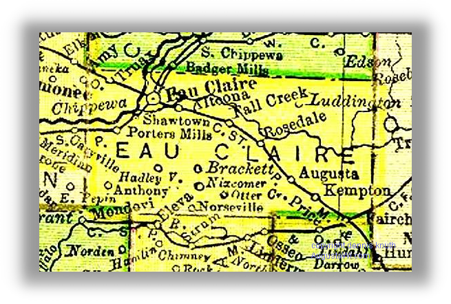
The Townships in Eau Claire County are Bridge Creek, Brunswick, Clear Creek, Drammen, Fairchild, Lincoln, Ludington, Otter Creek, Pleasant Valley, Seymour, Union, Washington, Wilson. Rosedale is now Rodell
Note that Rodell Wisconsin, between Augusta and Fall Creak, was identified as Rosedale Wisconsin. You can see why Rosedale Wisconsin is now Rodell Wisconsin on the Rodellwi.com web site.
Other disappearing towns on this Wisconsin Map are Kempton Wisconsin, Nizcomer Wisconsin, Hadley Wisconsin, Anthony Wisconsin, Norseville Wisconsin and Porters Mills Wisconsin. Truax Wisconsin has been swallowed up by Eau Claire Wisconsin as has been Shawtown Wisconsin and and Porter Mills Wis - the closest you can get is Truax Boulevard in Eau Claire.